BlogProtected Areas of Nepal
14 Jan 2020 snowpath
Protected areas of Nepal is divided into 12 National park, 6 conservation area, 1 wildlife reserve and 1 Hunting reserve. Plus, numerous Ramsar sites (wetlands) certainly highlights how rich is Nepal in ecological biodiversity. But should trekker and traveller really need to know about protected areas of Nepal? We believe yes. The location of these protected areas (how far from the capital city Kathmandu) can highly affect other factors like itinerary, transportation, cost, luxury, permit and so on.
The protected areas of Nepal, is dispersed throughout the country from farther north to south and farther east to west. Each with different climatic zone, landscape and distinguishable ecosystem. The national park and conservation area in northern part of the country is popular among the trekker. Notably, Rara National park, Shey Phoksundo National park, Annapurna Conservation area, Manaslu Conservation Area, Langtang National Park, Sagarmatha National park, Makalu Barun National park, Kanchenjunga Conservation Area. Most of the popular trekking itineraries of Nepal falls under above mentioned national park and conservation ares. These protected areas of Nepal in northern side are named from popular geographical landmarks like highest mountains and popular lakes.
The protected areas of Nepal in southern part is popular for wildlife devotee. Generally, that includes itinerary of jungle safari and Nepal tour. Bardiya and Chitwan National parks are two most popular destination among the traveller to enjoy the tropical ecosystem of Nepal. Koshi Tappu Wildlife reserve is one of the renowned protected areas of Nepal for birdwatching.
The one and only Hunting reserve, Dhorpatan is a place where one can display their hunting skill.
National Parks
Each National park has different characteristics depending on their location. Landscape, culture and ecosystem do not match each other. However, comparing the popularity of national park, all of them are not well-received by trekkers and travellers. For example, Khaptad National park is not as popular as Langtang National park due to various reasons like flexibility, long-distance from capital city, transportation option, infrastructure. Here, we provide a short glimpse of each national Park.
1.Shuklaphanta National Park
Shuklaphanta National park is situated in Kanchanpur , Far west Terai district of Nepal. The national park covers the area of 305 Sq.km. The phant is open grassland and wetlands, main characteristic of Shuklaphanta National Park.
The park is very popular for swamp deer with the highest density per area in the world. The park has 700 different species of plants equally comprising of trees, herbs, shrubs and grass. The park is home to 46 mammals, 12 species of reptiles and amphibians. More than 424 bird species can be found in Shuklaphanta National park.
Flying Dhangadi from Kathmandu is the best modes of transportation for Shuklaphanta Jungle safari itinerary. Moreover, beside jungle safari, traveller can experience and enjoy lifestyles and cultures of Far- west Terai people residing in the region.
2.Khaptad National Park
Khaptad National Park covers the area of 216 Sq.km. It is located in Far-west region of Nepal covering Bajhang, Bajura, Achham and Doti district. The region is very rich with distinguishable culture of ethnic community highly different than the rest of Nepal. The protected areas of Nepal is named after renowned spiritual saint/philosopher Khaptad Baba.
The national park has lower temperate to sub-alpine climatic zone in between altitude of 1400m-3300m. With such a small area, still the Khaptad national park is home to 567 species of flora, 23 species of mammals, 287 species of birds and 23 species of reptiles and amphibians.
Khaptad National Park has few itineraries in term of numbers. Khaptad trekking itinerary is only known itinerary, and only visited by few trekkers because of poor publicity and infrastructures. Trekking generally starts upon driving/flying Dhangadhi from Kathmandu. Khaptad National Park Permit and TIMS card is necessary to trek in the region.
3. Rara National Park
The Rara National Park covers the area of 106 sq.km. The protected areas of Nepal receives the name from one of the biggest and deepest lake in high altitude of Himalaya, Rara. The National park is situated in Karnali Province covering Mugu and Jumla district.
Rara National park covers the altitude in between 2800m to 4039m. Thus trekker can enjoy temperate landscape to sub-alpine landscape during trekking. The park also records 1070 species of different floras, 51 species of mammals, 241 species of birds, 2 species of reptiles and amphibians.
The standard way to trek to Rara lake is to fly Nepalgunj from Kathmandu and ultimately to Jumla from Nepalgunj. Again, the expensive transportation appeals few trekkers to Rara trekking. Combining the itinerary with another popular Shey Phoksundo lake in the region multiplies the adventure of trekking. Rara National Park Permit and TIMS card is necessary to trek around Rara National park.
4. Shey Phoksundo National Park
Shey Phoksundo is the biggest national park of Nepal with area 3555 Sq.Km. This protected areas of Nepal is named after one of the oldest monastery Shey Gompa, built around 11th century and high-altitude lake Phoksundo . The national park covers the Dolpo and Mugu district of Nepal.
The park stretches in between the altitude of 2130m to 6885m. That basically covers temperate, sub-alpine and alpine climatic zone including Trans-Himalaya landscape. 200 different species of birds, 6 reptiles and 29 species of butterfly are some other natural assets of the National park.
Due to massive area, this protected areas of Nepal has numerous possible trekking itineraries. Upper Dolpo and Lower Dolpo are the most popular trekking itineraries in the region. Generally trekker flies Nepalgunj from Kathmandu and to (Juphal) Dolpo Airport to start the trekking. The trekking ends flying from Jumla Airport to Nepalgunj and ultimately to Kathmandu. Again, the expensive transportation and poor infrastructures in the region is killing potential number of trekkers. Depending upon itinerary, trekker needs to obtain restricted are permit for upper/lower Dolpo trek, Shey Phoksundo National Park permit and TIMS card.
5. Bardiya National Park
Situated in the southern low land of Nepal, the Bardiya National park covers the area of 968 sq.km. Adjoint to Banke National park, the protected area has dense tropical and sub-tropical deciduous forest with grassland. The Karnali and Babai river provide enormous life-line to wildlife and the eco-system in overall.
The Bardiya National park has 839 species of flora that provides habitat to 53 mammals, 23 reptiles and 407 species of birds. This protected areas of Nepal is very popular for Royal Bengal tiger. Substantial donation from Hollywood star Leonardo-DiCaprio has helped increase the tiger population in the park.
Beside popular for Jungle safari, the periphery of Bardiya National park is dominated by the culture and tradition of Tharu people. Jungle safari in Bardiya National park can be unique experience for any traveller to understand Nepal in short span of stay. Good infrastructures in Terai region of Nepal, along with easy transportation means any traveller has easy access to Bardiya National Park.
6. Banke National Park
Newly established, Banke National covers the area of 550 Sq.km. The main objective to establish Banke National park is to increase population of Royal Bengal tiger by expanding habitat and to provide safe and natural migration route. Adjacent to popular Bardiya National park, the park is rich with deciduous forest, open grassland and savannah, perfect habitat for numerous wildlife. The National park covers Banke, Dang and Salyan district.
The Banke National Park has recorded 124 different trees including herbs, shrubs and climbers. 32 mammals, more than three hundred species of birds, 58 types of fish, 22 reptiles and 6 species of amphibians are found in the park. Beside the park is also home to 11 types of rear mammals and 50 plus species of rear birds.
Wildlife lover can combine Banke jungle Safari with Bardiya for maximum paybacks. Needless to say, traveller can experience authentic Tharu culture and tradition. Traveller can use road transportation or fly to Nepalgunj, depending on budget, itinerary and number of days they have.
7.Chitwan National Park
Chitwan National park is another southern lowland National park that covers Chitwan, Nawalpur, Parsa and Makwanpur district of Nepal. This protected areas of Nepal is also UNESCO world Heritage site, granted in year 1984. The National Park covers the area of 952.63 Sq.km. The park has deciduous forest along with open grassland and savannah.
The park has the most diversified ecosystem. The park is home to 68 different mammal species. More than 19 species of reptiles are found in the park. More than 543 species of birds are found in Chitwan National Park alone. Beside, one-horned rhinoceros is the main attraction of Chitwan National park. There are 93 elusive Royal Bengal tiger as per the census of 2018. Bishajari Tal is another attraction in Chitwan.
UNESCO World Heritage site, nearby Kathmandu, easy modes of transportation, good infrastructure makes Chitwan National park number one spot for Jungle safari. Though, Tharu are the main ethnic community, the internal migration within the country has diversified the culture and traditions around the park.
8. Parsa National Park
The Parsa National park used to be wildlife reserve which formally became National park in 2017. The National park is situated in east side of Chitwan National park. The park expands in three districts Parsa, Makwanpur and Bara, inner Terai region of Nepal. The park has area of 627.39 sq.km.
The park has elevation in between 435m to 950m. The silwalik hills is the main characteristics of the Parsa National park that ranges between 9m to 18m. The landscape usually looks dry. Still, 919 species of tropical and sub-tropical plants provide home to numerous animals. Indian bison is the main attraction of Parsa national park. The park also provides natural migration route for Royal Bengal tigers of Nepal and India. The illegal depletion of natural resources in the region is main concern. However, the situation is improving and the increment of different wild lives in the park is positive sign.
Flying to Bharatpur airport of Chitwan and driving to Parsa is the best way to do Jungle safari in Parsa National park. The park still lacks publicity and recognition to boost the tourism in the region. Doubtless, traveller can experience and enjoy different landscape in southern lowland of inner Terai region.
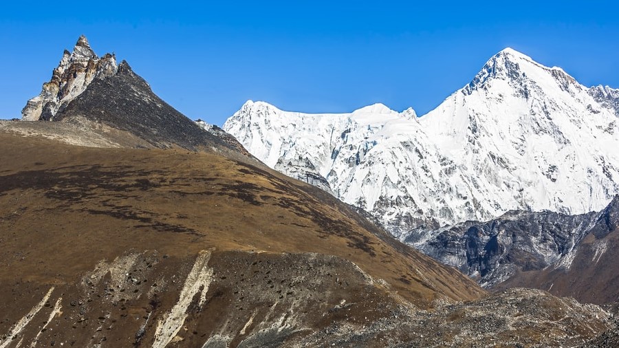
9. Langtang National Park
Langtang National Park is one of the most popular trekking destination of Nepal. It covers the central districts of Nepal, Rasuwa, Nuwakot and Sindhupalchwok . The Park covers the area of 1717 Sq.km. The park has diversified ecosystem composed of tropical, temperate, sub-alpine, alpine and snowline that stretches from as low as 1000m to 6450m.
Gosaikunda Lake at the altitude of 4300m, numerous mountain and peaks, rich cultural heritage of Tamang people in the National park are some not to miss highlights. Numerous types of trekking itineraries from short to long, easy to moderate make Langtang National park popular among experienced as well as amateur trekkers. Langtang Valley trek, Langtang Tamang Heritage trek, Langtang Gosaikunda trek, Helambu trek are few popular trekking itineraries out of many more.
There are numerous ways to start and end the trek in Langtang region. Driving to Syabrubeshi in local or private vehicle is the most popular trend among the trekkers. Dhunche, Melamchigaun, Sundarijal are some other spots to start and end the trek. Langtang National Park permit and TIMS card permit is necessary to trek in the region.
10. Shivapuri National Park
Shivapuri National park is adjacent to capital city, Kathmandu that covers the area of 159 Sq.km. The park covers three central district Kathmandu, Nuwakot and Sindhupalchowk. The park is sort of buffer zone in between temperate and sub-alpine climatic zone that mostly covers the hilly region.
The Shivapuri National park is also equally rich in floras and faunas. However, continuous breach of National park due to overflow of people makes hard to spot any animals for real. Numerous internal tourists choose the Shivapuri National park for day hiking plus picnic spots in the outskirts of park has greatly affected the habitat of animals. Experts have successfully recorded the existence of endangered animals like Leopard and black bear.
The easy transportation access to Shivapuri National park means one can combine various activity within short span of time. Birdwatching, trekking, cycling along with cultural and historical sightseeing of Kathmandu, Bhaktapur and Patan is popular among the traveller. Kakani, Nagarkot, Chisapani are some view points to enjoy the Langtang and Ganesh Himal ranges in the northern side of country. Ones need to pay Shivapuri National park fee and TIMS card fee to enter Shivapuri National park.
11. Sagarmatha National Park
Popular for Everest trekking, another UNESCO World heritage site, Sagarmatha National park covers the area of 1148 Sq.km in the Solukhumbu district. Highly popular among the trekkers and climbers the park receives the name from Sagramatha ( Mount Everest). The park is stretched in between the altitude of 2845m to summit of Mount Everest 8848m. Thus, trekkers and climbers can enjoy different climatic zone in between temperate, alpine and snowline during trekking and climbing.
Beside Mount Everest itself, Lhotse and Cho-Oyu are 4th and 6th highest mountain also comes under Sagarmatha National park. Sherpa culture and tradition are other well-known heritage of the parks. Numerous trekking itineraries make Sagarmatha National park one of the busiest protected areas in Nepal. Everest Base camp, Gokyo lakes, three passes are some popular sections in the park for trekking beside other peak climbing and mountaineering activity.
The classic Everest trekking starts upon driving to Jiri and ends on reaching Everest base camp. However, these days flying directly to Lukla is popular to save money and time that provides maximum opportunity to explore other hidden sections of Sagarmatha National park. Trekkers need to pay for Sagarmatha National Park permit and TIMS card. Besides, climbers and mountaineers need to pay royalty to climb peaks and mountains depending upon their choice.
12. Makalu Barun National Park
Named after the fifth highest mountain in the world Mount Makalu (8463m) and mount Baruntse ( 7129m), Makalu Barun National park covers the area of 1500 Sq.km. The park covers the highly diversified eco system around Arun and Barun valley that expands between eastern districts of Solukhumbu and Sankhuwasabha. The National park has elevation between altitude as low as 344m to summit of Maklau peak, 8463m. Also, highly diversified cultural community is highlights of the park that displays tradition and lifestyles of people like Limbu, Sherpa, Yakkha, Gurung, Magar living in different altitudes of the park.
Adjacent to Sagarmatha National park, trekking in Makalu Barun National park provides exceptional opportunity to explore eastern landscape and climatic zone of Nepal. Amazingly, 88 species of mammals, 440 species of birds, 43 species of reptiles, and 16 species of amphibians are found in Makalu Barun National park alone.
The trekking to Makalu Barun has not been as popular as it should have been considering rich cultural and natural aspects. However, there is no doubt that Makalu Barun trekking will gain high momentum in near future. The trek starts flying Tumlingtar from Kathmandu and ends flying Kathmandu from Tumlingtar. Beside restricted area trekking permit, trekker needs to obtain Makalu Barun National Park permit and TIMS card to trek in the region.
Conservation Area
Similar to National park, there are 6 conservation areas that are situated in different part of the country. Moreover, except Krishnasar Conservation Area in southern lowland, most of the conservation area are found in northern section of the country and highly popular among the trekkers. Annapurna Conservation Area and Manaslu Conservation Area remains highly busy and crowded in trekking season comparing to Api Nampa, Gaurishankar and Kanchenjunga Conservation Area. Again, transportation options, infrastructures, lengthy transfer to start and end trek from Kathmandu are some aspects that affects popularity of trekking in different Conservation Areas of Nepal. In other words, the Conservation Area in central part of country is popular than that of far-west and far-east.
1. Api Nampa Conservation Area
Api Nampa Conservation Area is named after two different peak Api and Nampa at Far western region of Nepal. The conservation area covers one of the least developed district of Nepal Darchula. With area of 1903 Sq.km. the Api Nampa Conservation area has altitude in between 518m to 7132m.
Established in year 2010, the purpose is to protect valuable natural resources of Far west region of Nepal. As well, the conservation area has interesting eco system comprised of tropical to snowline climatic zone that starts from India and joins to Tibet. The conservation area is also home to many endangered mammals, birds and reptiles. Also, the culture tradition and language of people of Far western has unique importance that amazes many Nepalese people as well.
Currently due to less publicity and promotion of Api Nampa Conservation Area, insignificant number of people visit the region. However, the long-term plan of government is to alleviate poverty of the region by increasing tourism activities. One can explore the conservation area upon flying Dhangadi from Kathmandu.
2.Krishnasar (Blackbuck) Conservation Area
The only purpose to establish Krishnasar ( Blackbuck) conservation area is to increase the number of this highly endangered animal species Blackbuck. The Krishnasar Conservation Area covers 16.95 Sq.km in Bardiya district near by Bardiya and Banke National park.
At first census, there were only about 9 blackbucks. After establishing the Conservation area the number has increased to 281. The open green grassland is home to blackbucks. Government has plan to handover this protected area to local community in near future.
Wildlife enthusiast can combine a tour of Krishnasar Conservation area along with Banke/ Bardiya Jungle safari. Needless to say traveller can explore culture and tradition of Tharu people residing in deep Terai region of Nepal.
3. Annapurna Conservation Area
Annapurna Conservation Area covers massive area of 7629 sq.km in western region of Nepal. The area covers five districts of Nepal, Kaski, Lamjung, Myagdi, Mustang and Manang. The conservation area receives the name from mount Annapurna ( 8091m) , tenth highest mountain in the world. The conservation area has altitude in between 790m to 8091m with varieties of landscape from tropical , temperate, sub-alpine, alpine , snowline and Trans-Himalaya.
The numerous types of trekking itineraries in the conservation area attracts many trekker from the world. Beside, mount Annapurna, Mount Dhaulagiri (8167m) seventh highest mountain in the world is another attraction. Popular among trekkers and climbers, Annapurna conservation area is congested with plentiful peaks and mountains. As shallow and easy Ghorepani Ghandruk trek to as demanding as Mesokanto-La pass, Annapurna delivers spot on as per demand of trekkers. Upper Mustang, Round Annapurna, Nar Phu valley trek, Mardi Himal trek, Tilicho lake trek are some popular itinerary within Annapurna Conservation Area. Needless to say, the cultural diversity is amazingly unique and fascinating.
Pokhara and Besisahar are gateway and exit point to start and end trek in Annapurna Conservation Area. Only road transportation is available to and from Kathmandu to Besisahar. While trekker has numerous options to reach Pokhara from Kathmandu and vice-versa. Annapurna Conservation Area permit and TIMS card is necessary to trek in Annapurna. Depending upon, trekkers might need to obtain restricted area permit to trek around some places like Mustang, Nar Phu. For climbers and mountaineers, one need to obtain permission either from Department of Tourism or NMA.
4. Manaslu Conservation Area
Adjacent to Annapurna Conservation area, Manaslu conservation area covers 1663 Sq.km. The name is derived from Mount Manaslu ( 8163m) , eighth highest mountain in the world. The altitude of Manaslu conservation ranges from 1400m to top of Manaslu 8163m. However, trekking starts from as low as 550m. The Conservation Area covers massive section of Gorkha district along with small section of Manang of Annapurna region.
Round Manaslu trek, Tsum valley trek and Ruby valley trek are some designated trekking itinerary in Manaslu Conservation Area. Former two are highly popular among the trekkers. Also, there is possibility to combine Round Manaslu and Tsum valley trek. Furthermore, trekker can continue to trek in Annapurna region after completing Round Manaslu trek. Nubri and Tsum are two popular ethnic community in upper trekking region. While, lower trekking region has diversified community of Brahmin, Chhetri, Magar, Gurung and many more.
After construction of road in Annapurna, this Conservation area came in radar among the true trekkers. Road is the only modes of transportation in the region to start trek. Trekker needs to obtain Manaslu Conservation Area permit and TIMS card to trek in the region. For both Round Manaslu and Tsum valley, trekker has to purchase restricted area permit from Department of immigration along with the help of trekking agency. For peak climbing and mountaineering, permit shall be obtained from either Department of Tourism or NMA.
5.Gaurishankar Conservation Area
Gaurishankar Conservation area is literally sandwiched in between Langtang national Park in west and Sagarmatha National park in east. Established in 2010, it has area of 2179 Sq.km. that stretches in three eastern districts Ramechhap, Dolkha and Sindhupalchowk. The elevation between 968m to 7181m means, the Conservation area has tropical, temperate, alpine and snowline climatic zone. Popular as Rolwaling ranges, the conservation area is named after peak Gaurishankar (7134m) the second highest peak in the region after Melungtse (7181m)
Popular as Rolwaling trek, the trek is challenging and is not highly popular among general trekkers. The itinerary joins to Sagarmatha National park through demanding Tashi Lapcha pass ( 5755m), beside walking thorough glaciated terrains for number of days. Tsho Rolpa Tal, one of the biggest glacier lake at altitude 4500m is another highlight of the trekking including Panch Pokhari, Bhairav Kunda. Trekker has advantage of enjoying different landscape of three different protected areas of Nepal, in single itinerary.
The trekking in Gaurishankar Conservation Area region starts upon driving to Charikot of Dolakha district and ends upon flying out from Lukla. Beside Gaurishankar Conservation Area Permit and TIMS card, trekker needs to obtain restricted area trekking permit from Department of Immigration.
6. Kanchenjunga Conservation Area
Kanchenjunga Conservation Area is situated in Taplejung district, far-east region of Nepal. It covers area of 2035 Sq.km and the altitude of Conservation area ranges from 1200 to 8586m including summit of Mount Kanchenjunga, the third highest mountain in the world. Trekker can experience and enjoy diversified climatic zone of far-east region starting from tropical to snowline through trekking.
Kanchenjunga Circuit/ Kanchenjunga Base camp is the most popular trekking itinerary in the region. There are not much itinerary options like that of Annapurna or Everest. Trekker has option to trek on both North and South Base camp thorough Sele-La pass or can complete only one base camp depending upon number of days. Extra-ordinarily beautiful, but the distance from capital city Kathmandu to start trek is killing number of trekkers. Cultural diversity is another good reason to trek in the region dominated by different ethnic community under the umbrella of Kiratis.
Driving to Taplejung from Kathmandu is not a wise option, if there is flight to Suketar, especially to save trekking days. Flying to Bhadrapur and driving to Taplejung can be another option. Trekker needs to obtain restricted area trekking permit along with Kanchenjunga Conservation Area Permit and TIMS card.
After converting Shuklphanta and Parsa protected areas from Wildlife reserve to National park, there remains only 1 wildlife reserve, Koshi Tappu. It still remains controversial; wildlife reserves were highly misused by ruling class of Nepal as hunting ground.
1.Koshi Tappu Wildlife Reserve
The only wildlife reserve of Nepal has area of 175 Sq.km. The Wildlife reserve expands in three districts Sunsari, Saptari and Udayapur of eastern Terai. The altitude of park ranges between 75m to 81m. The protected area has mostly wet grassland and marshes due to Saptakoshi river including deciduous forest. A perfect habitat for many herbivore species.
Although in small area, the park has unique ecosystem due to fertile land and abundant amount of fresh water. Wild water buffalo and winter migrating bird is synonym to Koshi Tappu wildlife reserve. 200 species of fish, 2 species of toad, 9 species of frog, 6 species of lizard,11 species of turtles are found in the reserve. There are 485 species of birds. Some highly endangered bird species often migrate to Koshi Tappu. Interestingly, to maintain the ecosystem of the Koshi Tappu , government often conduct transfer of carnivores and herbivores with Chitwan National park.
Flying to Biratnagar and using road transport would be best option to reach Koshi Tappu wildlife reserve. It also can be an exceptional opportunity to explore eastern Terai of Nepal.
Hunting Reserve
Dhorpatan Hunting Reserve is only one of its kind in Nepal. The Hunting reserve has the area of 1325 Sq.km situated in western side of Nepal. The area covers Rukum, Myagdi and Baglung districts. It has elevation in between 2850m to 5500m comprising temperate, alpine and snowline climatic zone.
The reserve equally has flat meadows and dense forest providing habitat to different animals and birds. 18 species of mammals and 137 species of birds are found in the region, including some highly endangered species.
Even though, it is hunting reserve, government allocates quotas and provide hunting permit under bidding system after extensive study. Earning foreign currency upon allowing to hunt over-populated species is sole purpose of Dhorpatan Hunting reserve. However, there is no doubt the reserve also plays vital role to protect endangered species.
The process to obtain license to hunt in the region is itself very complex and expensive. One should be aware of arm and ammunition. Prove and demonstrate skills and past experiences of hunting thoroughly. As per now, only Blue sheep and Himalayan Tahr are allowed to hunt. We don’t believe government will allow hunting any other animal species now or in future. Afterall, protecting wildlife is the main objective even though it is a Hunting reserve.